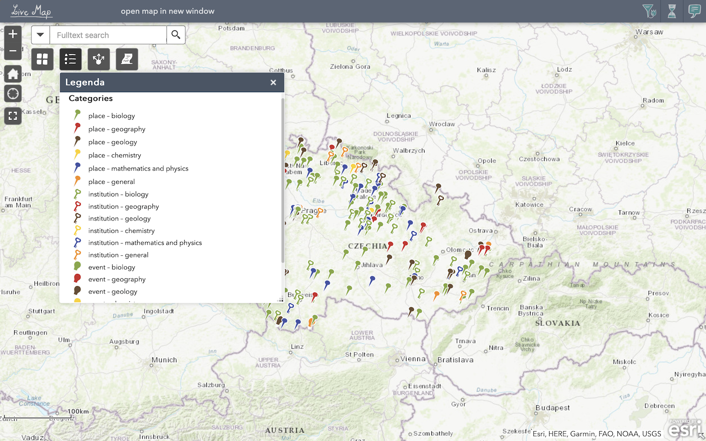
In the Live Map application, you can search directly for specific entries. They are distinguished by colour (each scientific discipline has a different colour) and also by type (place, institution, event). The legend is displayed by clicking on the corresponding icon.
You can browse the map by putting GPS coordinates, keywords or localization in the search engine window on the left. Or you can use filters for scientific discipline or century on the right.
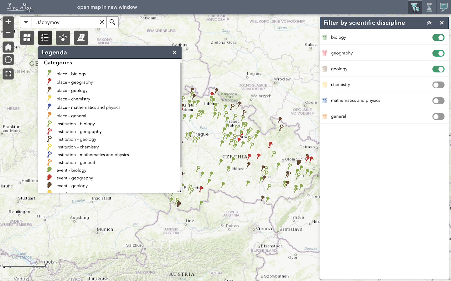
Use filters for different scientific disciplines or for different centuries (14th – 21st century).
You can choose different background maps in the menu or leave the original basemap.
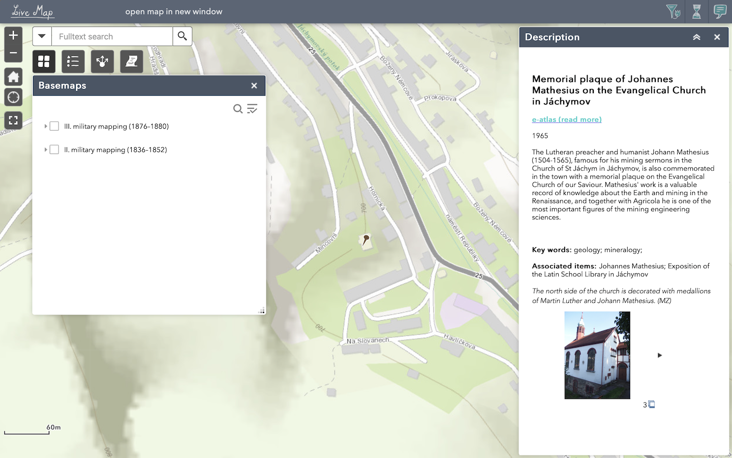
The basic setting is a topographic map (ESRI, HERE, Garmin, FAO, USGS, NGA). It is possible to add the following two other basemaps: mosaics of maps III. Military Mapping (1876–1880) and II. Military Mapping (1836-1852).
A basic description of the point containing a brief annotation, keywords and a photo will be displayed in its own window when you click on the selected point. If you click the e-atlas link, detailed information and other associated entries will be displayed:
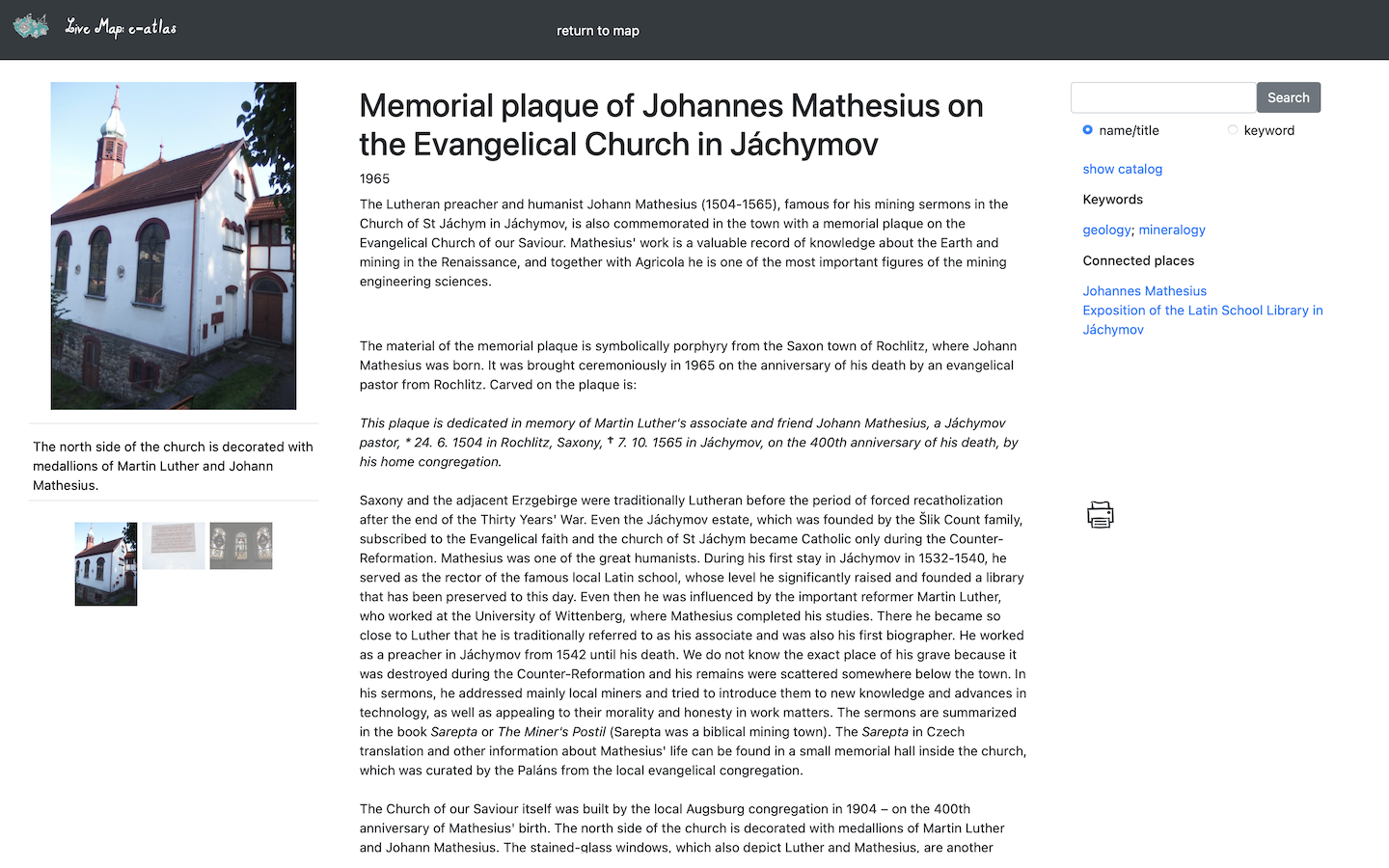
E-atlas is an application that links map entries with detailed descriptions and also allows you to track their interrelationships through Associated Entries. In addition to the places that have their exact topographic designation, it also includes further information on cards of important people connected to the place. (For example J. Mathesius and G. Agricola are connected with Renaissance places in Jáchymov whereas the Monument of the Discovery of Radium will be connected with people like F. Běhounek and M. Curie Sklodovska).
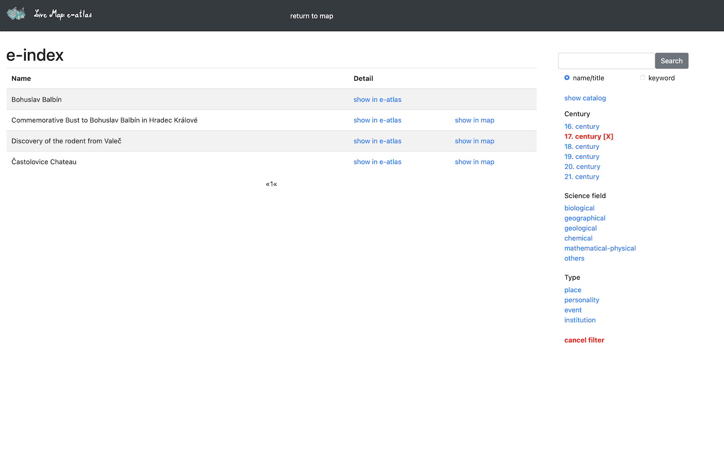
The e-atlas can also be browsed independently of the map and searched by keywords and filter settings. After entering a search word (keyword or name) into the search engine window, the e-index is displayed:
Linking places and historical figures through associated entries provides more insight and a wider network of contexts.
The map can be shared on social media, by e-mail, or on a website using HTML code; it can also be printed in PDF, PNG and JPG formats.